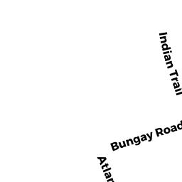
BUNGAY RD
Owner Information
WALSH PATRICK J + LAWLESS KEVIN J
484 LINDSEY ST
ATTLEBORO, MA 02703


Property Details
BUNGAY RD is classified as a Undevelopable Residential Land (Vacant land).
BUNGAY RD is valued at $12,300. The land is valued at $12,300 and the structures are valued at $0.
The most recent deed for BUNGAY RD is recorded at the local registrar in Book 00027, Page 0152. BUNGAY RD was last sold on Wednesday, January 1, 1975 for $0.
Assessment data from fiscal year 2022.
Flood Data
According to the FEMA National Flood Hazard Layer, this property does not appear to be in a flood zone. It may also be in an area not yet reviewed. Nonetheless, confirm this information prior to taking any action.
To view the flood hazards around this property, create a FEMA "Firmette" Map of the area around BUNGAY RD.
Broadband Internet Providers
| Provider | Type | Bandwidth (mbps) | |
|---|---|---|---|
| Comcast | Cable | 1000 | 35 |
| HughesNet | Satellite | 25 | 3 |
| Verizon New England Inc. | Fiber | 940 | 880 |
| GCI Communication Corp. | Satellite | 0 | 0 |
| Viasat Inc | Satellite | 100 | 3 |
| VSAT Systems, LLC. | Satellite | 2 | 1 |
| Verizon New England Inc. | DSL | 5 | 0 |
Broadband service provider data from December 2020.
Adjacent Properties
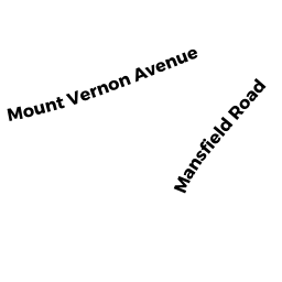
- MANSFIELD RD REAR
US GOVT MDL-00 owned by UNITED STATES OF AMERICA - 132 BUNGAY RD
Mixed Use Primarily Commercial owned by WALSH PATRICK J + LAWLESS KEVIN J - 21 INDIAN TRAIL
Developable Residential Land owned by GOBIN LILLIAN P - 35 INDIAN TRAIL
Single Family Residential owned by ALVES MICHAEL - 144 BUNGAY RD
United States Government owned by UNITED STATES OF AMERICA - BUNGAY RD
US GOVT MDL-00 owned by UNITED STATES OF AMERICA